Contact me via WhatsApp Chat with Catalina on WhatsApp

Category: Egypt History & Culture

  • The Green Circles of the Sahara

    The Green Circles of the Sahara

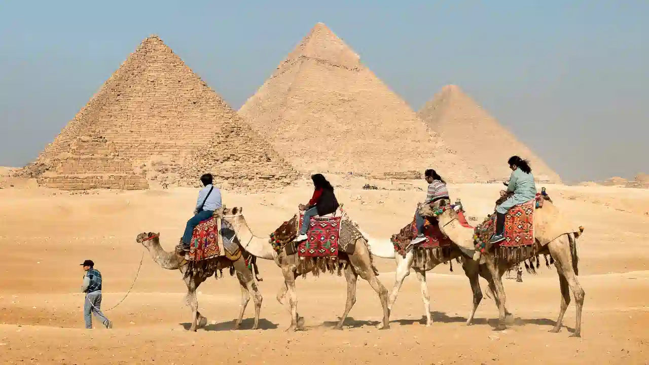
    Egypt’s Attempt to Conquer the Desert

    Before the Desert

    Ten thousand years ago the landscapes surrounding today’s Lake Nasser and the Western Desert looked profoundly different from what we see now.

    Large parts of the Sahara were not desert at all. They were savannahs, lakes and seasonal rivers. Rock art discovered across southern Egypt, Sudan and Libya shows animals that feel almost impossible in the modern Sahara: elephants, giraffes, lions and large herds of cattle. Crocodiles lived in lakes scattered across the region.

    Scientists refer to this era as the African Humid Period, when stronger monsoon systems brought far more rainfall into North Africa. What we now call the Sahara was then a vast ecological corridor where animals and humans could live far from the Nile.

    Over thousands of years the climate slowly changed. Subtle shifts in Earth’s orbital cycles altered rainfall patterns. The monsoons weakened, lakes dried, vegetation disappeared, and the Sahara gradually transformed into the immense desert we know today.

    Human populations migrated toward the one reliable artery of water that remained.
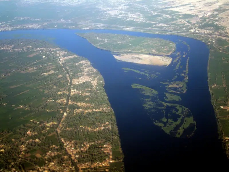
    The Nile.

    It was along this narrow ribbon of fertility that Egyptian civilisation emerged and endured for more than three millennia, surrounded by expanding seas of sand.

    As explored in The Nile: The River That Created Egypt, the river shaped not only agriculture but the entire geography of Egyptian civilisation.

    The Memory Still Exists in the Desert

    The ancient green Sahara is not only a theory of climate science. Its traces still exist on the ground.

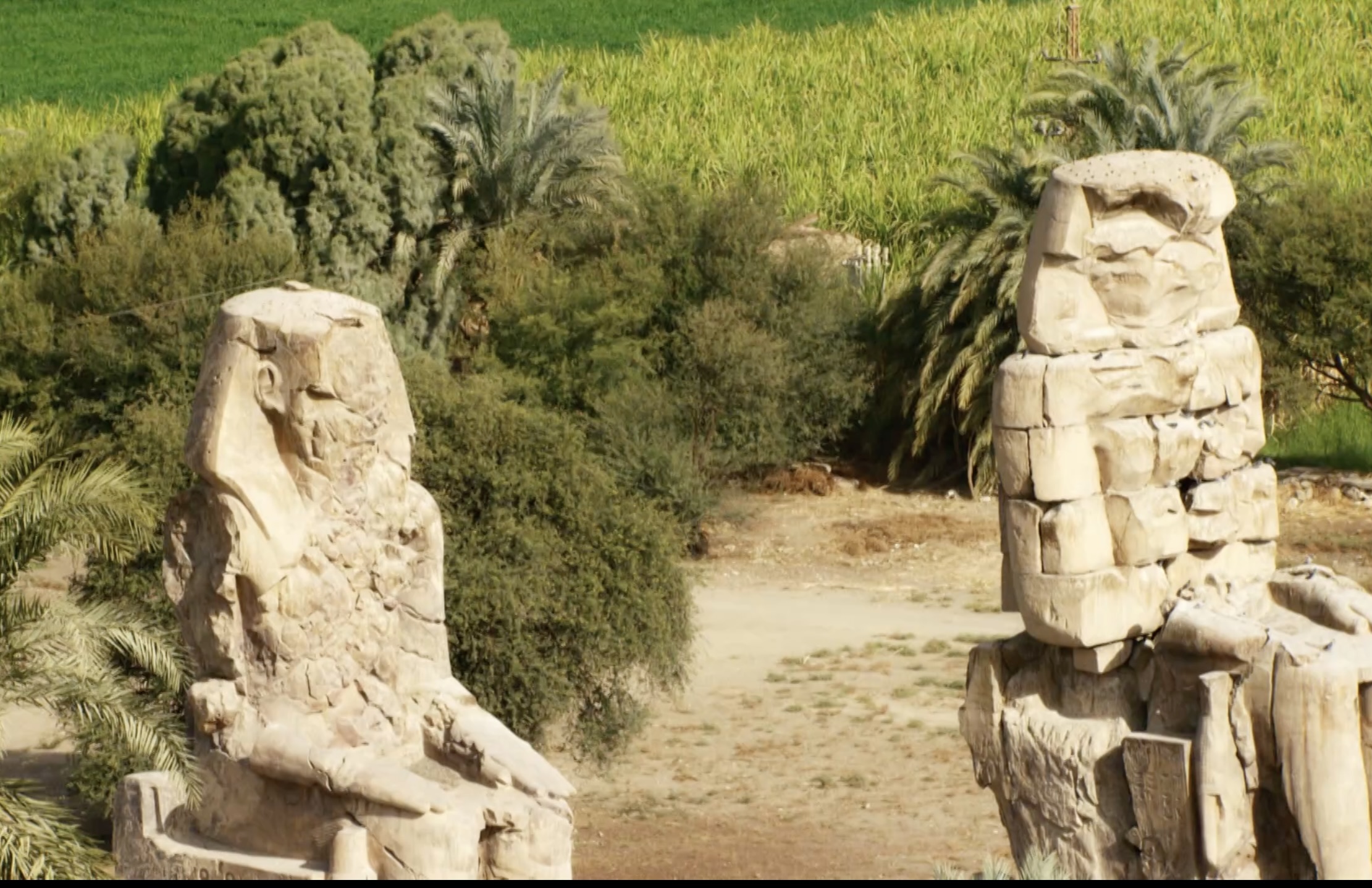
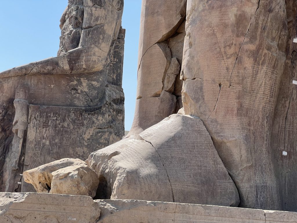
    In the remote expanses of Egypt’s Western Desert, particularly in Al-Wadi Al-Gadid near the Libyan border, archaeological remains reveal that people once lived far from the Nile. Stone tools, fragments of early settlements and other traces can still be found by those patient enough to explore the landscape.

    I have seen this myself while travelling through that region. Standing in those silent deserts, where the wind moves across endless sand and rock, it becomes easier to imagine that this landscape once supported life very differently from today.

    The Sahara carries a long memory beneath its surface.

    New Water, New Civilisations

    When the climate became drier, Egypt’s entire civilisation concentrated along the Nile valley. The river’s annual flood provided the water and fertile soil that sustained agriculture and population.

    Centuries later, in the 7th century, the Arab world brought new irrigation techniques to Egypt. Water wheels, canals and improved hydraulic systems expanded agricultural production and allowed cultivation to spread beyond the natural floodplain in some regions.

    Yet even then the desert itself remained largely unconquered.

    The Nile valley continued to define the limits of life in Egypt.

    The Twenty-First Century Experiment

    Today Egypt is attempting something far more ambitious.

    Modern engineering, drilling technology and large irrigation systems are pushing agriculture into landscapes that for thousands of years remained entirely barren.

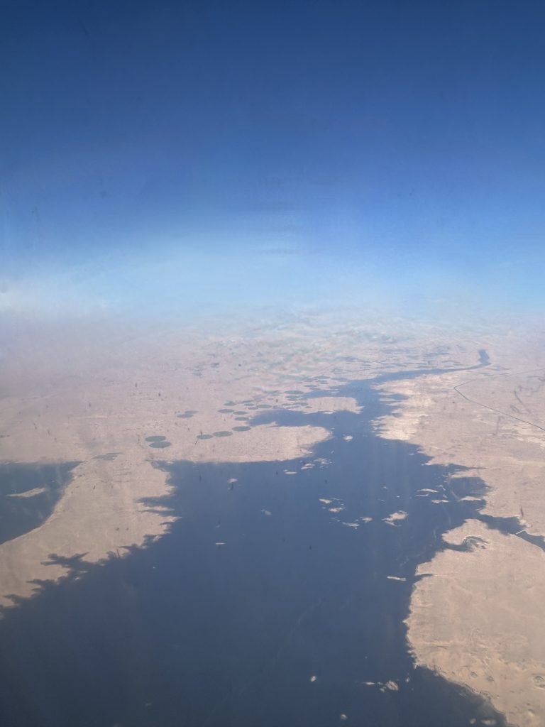
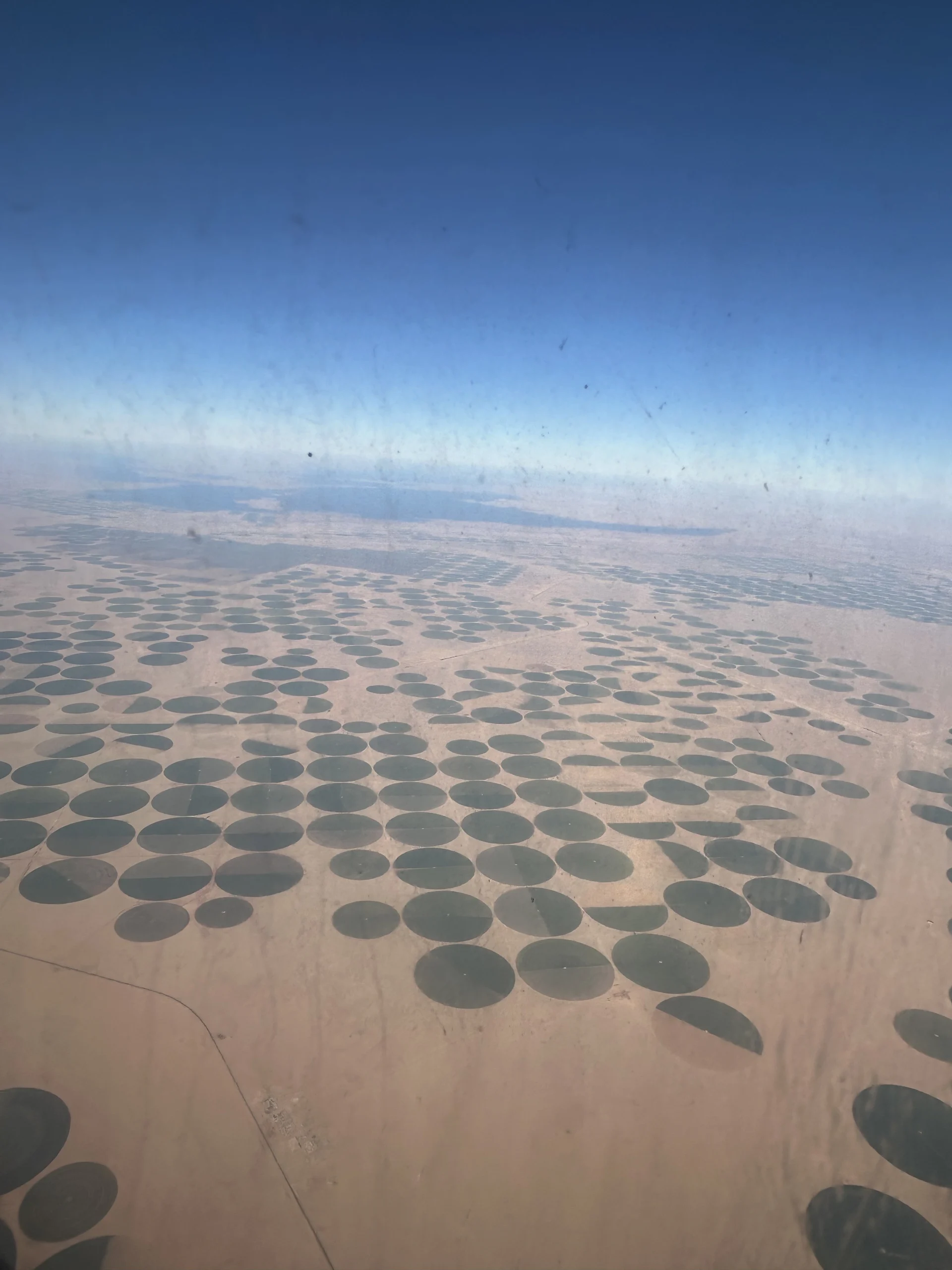
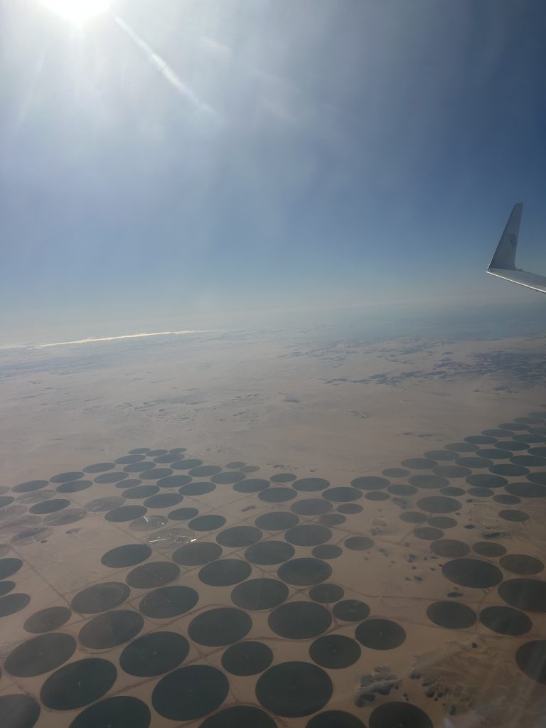
    Flying south over Egypt toward Abu Simbel, the desert stretches endlessly beneath the aircraft.

    Travellers visiting this region during Nile journeys through Upper Egypt, often discover how dramatically the landscape shifts from fertile riverbanks to vast desert.

    The green ribbon of the Nile has long disappeared. Only sand, rock and silence fill the horizon.

    And then, suddenly, something unexpected appears.

    Perfect green circles scattered across the desert.

    These circles are created by center-pivot irrigation systems, large rotating arms that distribute water around a central well. As the irrigation arm slowly turns, it waters crops in a perfect circle, producing the unmistakable geometric patterns visible from the air and even from satellites.

    Each circle may cover dozens of hectares of farmland.

    From the window of an airplane they look like coins placed carefully on the surface of the Sahara.

    The Engineering Behind the Circles

    Some of these farms rely on deep groundwater reserves such as the Nubian Sandstone Aquifer, one of the largest underground freshwater systems on Earth. Much of this water accumulated thousands of years ago when the Sahara was still a wetter landscape.

    But Egypt is also experimenting with something even more ambitious.

    In several regions, the government is pumping Nile water into the desert itself, extending canals and pipelines far beyond the traditional agricultural zones. Projects connected to the Toshka development south of Lake Nasser and other desert reclamation initiatives aim to transform large areas of previously barren land.

    This effort does not stop near Abu Simbel.

    The same vision extends further west toward the desert oases and regions such as Dakhla, where water infrastructure is being expanded to support new agricultural settlements.

    I have also seen some of these early stages myself. In certain places the engineering work is still in its infancy. Canals, pumping stations and new irrigation systems are only beginning to reshape the landscape.

    For now the desert still dominates.

    But the intention is clear.

    Egypt is attempting to move agriculture beyond the ancient limits imposed by the Nile valley.

    Islands of Green in an Ocean of Sand

    Seen from above, the green circles scattered across the Sahara are more than just farms.

    They are small experiments in rewriting the geography of life in Egypt.

    For thousands of years Egyptian civilisation depended almost entirely on the Nile. Today engineers, farmers and planners are cautiously pushing that boundary outward.

    Some projects will succeed.

    Others may struggle with the immense challenges of water, energy and climate.

    The Sahara has always tested those who attempt to tame it.

    Yet the circles visible from the air tell a remarkable story.

    After thousands of years living within the narrow ribbon of the Nile, Egypt is once again trying something extraordinary.

    To push life back into the desert.

    For thousands of years Egypt depended entirely on the Nile. Today, those green circles in the Sahara raise a fascinating question: how far beyond the river can life truly spread?

  • The Nile: The River That Created Egypt

    The Nile: The River That Created Egypt

    A Civilisation Built on a River

    If Egypt exists where it does, as we explored earlier, it is because of the Nile. But the river did far more than make life possible. It created the conditions for the longest-lasting civilisation in human history.

    For more than three millennia, from the early dynastic period around 3100 BCE until the Roman annexation of Egypt in 30 BCE, Egyptian civilisation maintained a remarkable cultural and political continuity. Dynasties rose and fell, capitals shifted, and foreign rulers occasionally appeared, yet the fundamental structure of Egyptian society—its religion, language, administration, and relationship with the Nile—remained recognisably the same.

    Few civilisations in history display such extraordinary longevity within the same geographical and cultural framework. The explanation lies not only in political organisation or religious tradition, but above all in geography. Egypt was shaped by a landscape unlike any other: a narrow fertile corridor carved by the Nile through vast surrounding deserts.

    Without the Nile, Egypt would have been an extension of the Sahara.

    With it, the land became one of the most productive agricultural regions of the ancient world. Each year the river flooded its banks, depositing fertile black silt that renewed the soil and made stable agriculture possible.

    It is no coincidence that the ancient Egyptians called their land Kemet, meaning “the Black Land,” referring to the dark fertile soil created by the flood. Beyond this narrow ribbon lay Deshret“the Red Land,” the immense deserts that surrounded and protected the valley.

    In this sense, Egypt was not simply a country beside a river. It was a civilisation created by one.

    The Three Seasons of the Nile

    The rhythm of Egyptian life followed the annual cycle of the river. The ancient Egyptian calendar was divided into three agricultural seasons, each determined by the behaviour of the Nile.

    Akhet — The Flood Season

    The first season, Akhet, lasted roughly from June to September. During this time the Nile overflowed its banks as rainfall from the Ethiopian highlands fed the Blue Nile.

    The floodwaters spread across the valley, covering fields and depositing the fertile silt that made Egyptian agriculture possible. Although farming paused during this period, the flood was welcomed as a divine gift.

    The abundance of the river was personified by the god Hapi, who symbolised fertility and prosperity.

    Peret — The Growing Season

    Once the waters receded, the second season began: Peret, the season of emergence and growth.

    Farmers ploughed the softened soil and planted crops such as wheat, barley, and flax. Irrigation channels carried water to the fields, allowing plants to grow throughout the valley.

    This was the moment when the miracle of the Nile revealed its full power. From a narrow ribbon of land, Egypt could produce food in abundance.

    Shemu — The Harvest Season

    The final season, Shemu, was the harvest season, extending roughly from March to May.

    Grain was gathered and stored in granaries, forming the agricultural surplus that supported the Egyptian state. That surplus fed cities, priests, craftsmen, and the labour force that built the pyramids and temples.

    Remarkably, the same agricultural rhythm shaped Egyptian life for thousands of years and is still recognisable in the country today.

    The Nile as Egypt’s First Highway

    Aerial view of the Nile River cutting through the desert landscape of Upper Egypt
    From the air, the Nile reveals its true nature — a narrow corridor of water and life crossing the vast Egyptian desert Photograph by Catalina Garay

    The Nile was not only the source of life and agriculture. It was also Egypt’s first great transportation system.

    The river flows naturally from south to north, descending from the highlands of East Africa toward the Mediterranean Sea — a geographical phenomenon explored in more detail in our article Why Does the Nile Flow North.

    At the same time, the prevailing winds of the Nile valley blow from north to south.

    This rare geographical balance created a natural navigation system. Boats travelling north could simply follow the current of the river, while boats travelling south could raise their sails and use the steady northern winds.

    This allowed movement in both directions along the river long before the construction of roads or modern infrastructure. Merchants, officials, pilgrims, and travellers moved along this watery corridor carrying goods, ideas, and traditions from one end of the country to the other.

    Even today, traditional sailing boats such as feluccas and dahabiyas still rely on this same natural relationship between current and wind.

    The Nile and the Birth of the Egyptian State

    Because nearly every settlement developed along the same river corridor, the Nile also shaped Egypt’s political organisation.

    Over time two major regions emerged:

    • Upper Egypt, the southern Nile valley

    • Lower Egypt, the northern Nile delta

    Around 3100 BCE, these regions were unified under a single ruler, traditionally identified as Narmer, marking the birth of the Egyptian state.

    The river itself made this unity possible. Communication, administration, and trade all followed the same geographical axis. Few ancient civilisations possessed such a clear natural structure for political cohesion.

    The Nile as a Sacred Landscape

    For the ancient Egyptians the Nile was far more than a physical river. It was a sacred presence woven into religion, myth, and cosmology.

    The annual flood symbolised rebirth and renewal. The myth of Osiris, god of the afterlife, reflected this idea: life emerging again after death, just as the flood renewed the land each year.

    Temples were often aligned with the river, and sacred processions moved along its waters during religious festivals. The Nile therefore shaped not only agriculture and politics but also the spiritual imagination of Egypt.

    The River That Still Defines Egypt

    Thousands of years later, the Nile continues to define Egypt’s geography and life.

    Modern cities, agriculture, and transportation still follow the same narrow valley that sustained ancient civilisation. From space, Egypt still appears as a striking contrast: a thin green ribbon running through a vast desert.

    Travelling along the Nile today reveals a landscape that has changed remarkably little over millennia,  something beautifully described in Nile Narratives: A Timeless Journey Through the Heart of Egypt.

    Temples, villages, palm groves, and desert cliffs still follow the same ancient rhythm of the river.

    Perhaps the real question is not how Egypt used the Nile, but how the Nile shaped Egypt itself.

    The deeper question, as Dr Watson might observe, is this: did a civilisation grow beside the Nile, or did the Nile itself create it?

  • Why Egypt Exists Where It Does

    Why Egypt Exists Where It Does

    The River, the Deserts, and the Geography That Created a Civilization

    Standing on the banks of the Nile, it is easy to forget that Egypt exists in one of the most unforgiving landscapes on Earth. Beyond the narrow ribbon of green that follows the river lies an immense expanse of desert stretching across thousands of kilometres. Yet precisely here, in this unlikely environment, one of the longest-lasting civilisations in human history emerged.

    More than two thousand years ago, the Greek historian Herodotus, writing in the 5th century BC, captured this reality in a simple but powerful phrase:

    “Egypt is the gift of the Nile.”

    What he meant was not merely poetic admiration. Egypt did not emerge by chance. Its existence is the result of a remarkable geographical balance between river, desert, climate, and trade routes. The Nile made life possible, while the surrounding deserts shaped the boundaries and stability of the civilisation that grew along its banks.

    Understanding why Egypt exists where it does means understanding the landscape itself.

    The Nile’s northward course is one of the defining geographical features of Egypt, explained in detail in Why Does the Nile Flow North?

    The Nile: A River That Created a Country

    Local people harvesting river plants from small boats along the Nile in Egypt
    Local workers collecting river vegetation from traditional boats on the Nile in Egypt.

    At the heart of Egypt lies the Nile River, one of the most remarkable waterways on Earth. The Nile is a major north-flowing river in northeastern Africa that empties into the Mediterranean Sea. At 7,088 kilometres in length, it is traditionally considered the longest river in the world.

    Despite its great length, the volume of water it carries is far smaller than that of other major rivers such as the Amazon or the Congo, whose tropical basins receive much heavier rainfall.

    What makes the Nile extraordinary is not its size alone but the role it played in shaping human civilisation. Each year the river flooded its banks, depositing nutrient-rich silt across the valley. This natural cycle transformed a narrow corridor of land into one of the most productive agricultural regions of the ancient world.

    Crops such as wheat and barley flourished, sustaining populations and allowing cities to develop along the river.

    Without the Nile, Egypt would simply be desert. With it, the land became the cradle of a civilisation that endured for more than three millennia.

    A River Shaped by Deep Geological Time

    Although the Nile seems eternal, geologically speaking it is a relatively young river. The river has flowed along roughly its present course for only about 12,000 years, after climatic changes at the end of the last Ice Age reshaped the drainage systems of northeastern Africa.

    Earlier geological periods saw very different river systems across the region. Only when climatic conditions stabilised did the Nile valley form the continuous river corridor we recognise today.

    In this sense, the landscape that allowed Egyptian civilisation to flourish is itself the result of relatively recent geological change.

    The Name of the Nile

    The name “Nile” carries its own long linguistic journey.

    The English word “Nile” derives from the Latin Nilus, which itself comes from the Ancient Greek Νεῖλος (Neilos). The Greek term may ultimately originate from the Semitic word naḥal, meaning “river” or “valley stream.”

    Ancient Egyptians themselves used different names for the river, often referring to it simply as Iteru, meaning “the river.”

    For them the Nile was not merely a geographical feature. It was the defining element of their world.

    A Green Corridor Through the Desert

    Seen from above, Egypt appears as a striking contrast. A thin band of fertile green land follows the Nile through a vast sea of sand and stone.

    This valley is rarely more than 10 to 20 kilometres wide, yet it supported millions of people throughout ancient history. Every settlement, temple, and agricultural field depended on the river’s presence.

    The Nile therefore functioned not only as a source of water but also as Egypt’s main highway. Boats travelling along the river connected cities, temples, markets, and villages across hundreds of kilometres.

    In this sense the Nile was more than a river. It was the spine of the country, the axis along which Egyptian civilisation developed.

    A River and a Wind That Made Travel Possible

    One of the most remarkable geographical features of the Nile is the natural system that made navigation possible for thousands of years.

    The river flows from south to north, descending gradually from the highlands of East Africa toward the Mediterranean Sea. At the same time, the prevailing winds in Egypt blow in the opposite direction, from north to south.

    This unique combination created a natural transportation system long before engines or modern infrastructure existed.

    Boats travelling northward could simply follow the current of the river.

    Boats travelling southward could raise their sails and use the steady northern winds to move against the current.

    Thanks to this natural balance between river flow and wind direction, ancient Egyptians were able to navigate the Nile with remarkable efficiency. Traders, officials, pilgrims, and travellers could move along the river in both directions using simple sailing vessels.

    This geographical advantage played a decisive role in the development of Egyptian civilisation. The Nile became not only a source of water and fertile soil but also the primary highway of the country.

    Even today, traditional sailing boats such as feluccas and dahabiyas continue to rely on this same natural relationship between river current and prevailing winds.

    The Deserts That Protected Egypt

    Surrounding the Nile valley are vast desert regions that shaped Egypt’s historical stability.

    To the west lies the Western Desert, part of the Sahara and one of the largest desert regions on Earth. Within it are dramatic landscapes such as the White Desert, the Black Desert, and the immense dune fields of the Great Sand Sea, punctuated by ancient oasis settlements including Siwa, Bahariya, Farafra, Dakhla, and Kharga.

    To the east stretches the Eastern Desert, a rugged mountainous region between the Nile and the Red Sea. This landscape contains ancient mining areas and caravan routes linking the Nile with Red Sea ports used in antiquity for trade with Arabia, East Africa, and India.

    Further north lies the Sinai Peninsula, a land bridge between Africa and Asia with its own unique desert mountains and plateaus.

    Together these desert regions created natural barriers around the Nile valley. While not impossible to cross, they discouraged large-scale invasions and helped protect the civilisation that developed along the river.

    A Natural Corridor Between Continents

    Although the deserts protected Egypt, they also helped define its position as a crossroads between continents.

    The Nile valley formed a natural corridor linking central Africa with the Mediterranean world. Through the Sinai Peninsula Egypt connected with the Near East and the Levant, while Red Sea ports linked the Nile to maritime routes reaching Arabia, East Africa, and India.

    Merchants, diplomats, pilgrims, and travellers all moved through this landscape, following routes shaped by geography thousands of years earlier.

    A Landscape That Shaped a Civilization

    Ancient Egyptian society developed in close harmony with the rhythms of the Nile and the structure of the surrounding land.

    Agriculture depended on the annual flood. Cities rose along the riverbanks. Temples were aligned with the movement of the sun and the flow of the river.

    Even the way Egyptians described their own country reflected this geography.

    River-Based Orientation

    Ancient Egyptians did not orient themselves primarily by north and south but by the direction of the river.

    • Upstream (south) was called Upper Egypt

    • Downstream (north) was called Lower Egypt

    The Nile defined orientation, agriculture, religion, and daily life. In many ways Egypt was not simply a country with a river. It was a civilisation built around one.

    The Same Geography Still Defines Egypt Today

    Thousands of years later the same geographical structure continues to shape Egypt.

    Modern cities, agriculture, and transportation still follow the Nile valley. Travellers exploring the country today move along the same corridor that ancient Egyptians used thousands of years ago.

    Travelling along the river today still reveals the same landscape that shaped Egyptian civilisation, as described in Nile Narratives: A Timeless Journey Through the Heart of Egypt.

    Sailing between Aswan and Luxor, watching the river pass temples, villages, and desert cliffs, one experiences the same landscape that once sustained pharaohs, traders, and pilgrims.

    The geography that created Egypt has never truly changed.

    The Nile still flows north. The deserts still frame the valley. And the narrow green corridor along the river remains the heart of the country.

  • Tourism in Roman Egypt: When the Ancient World Came to See the Nile

    Tourism in Roman Egypt: When the Ancient World Came to See the Nile

    Egypt After 30 BC: From Kingdom of the Pharaohs to Roman Imperial Province

    In 30 BC, after the defeat of Mark Antony and Cleopatra VII following the Battle of Actium (31 BC), Egypt was annexed by Emperor Augustus and transformed into a Roman imperial province. From that moment Egypt became one of the most strategically important territories of the Roman Empire. Its significance was not only cultural but deeply economic. Egypt rapidly became the breadbasket of Rome, supplying enormous quantities of grain that fed the population of the imperial capital. At the time Rome was the largest city in the known world, with perhaps one million inhabitants, and its food supply depended heavily on the fertile harvests of the Nile valley. Yet Egypt was already famous long before the Romans arrived. When Roman travellers came to the Nile they encountered monuments that were already more than two and a half millennia old. For them, Egypt was not merely another province; it was a land of ancient wonders.

    Monuments Already Ancient to the Romans

    By the first century AD the Great Pyramids of Giza, constructed around 2600–2500 BC during the Fourth Dynasty, were already among the oldest monumental structures still standing anywhere on Earth. Roman travellers visited them with the same sense of awe experienced by modern visitors. Evidence of these ancient travellers survives in the form of Greek and Latin graffiti carved into temple walls and monuments. One of the most fascinating examples comes from the Colossi of Memnon near Thebes (modern Luxor). After an earthquake in 27 BC, one of the giant statues began to produce a mysterious sound at sunrise due to cracks in the stone. Romans believed the statue was singing. Visitors from across the empire travelled to hear the phenomenon and carved inscriptions on the monument recording their presence. One Roman traveller wrote a short message that has survived nearly two thousand years: “I, Gaius Julius Balbillus, heard the voice of Memnon.” These inscriptions are among the earliest surviving examples of something that feels very much like tourist graffiti.

    Roman travellers were so impressed by the site that many carved their names into the statue itself. More than one hundred inscriptions left by visitors between the 1st and 3rd centuries AD still survive today.

    Ancient Greek and Roman inscriptions carved by travellers on the Colossi of Memnon in Luxor
    Greek and Roman inscriptions carved by visitors on the Colossi of Memnon near Luxor. Travellers from across the Roman Empire recorded their visits here between the 1st and 3rd centuries AD.

    Alexandria: Intellectual Capital of the Roman Mediterranean

    One of the most important destinations for Roman visitors was Alexandria, founded in 331 BC by Alexander the Great. By the Roman period the city had become one of the largest and most cosmopolitan cities in the Mediterranean world. It was second only to Rome in population and importance. Alexandria’s reputation rested largely on its intellectual life. The city was home to the famous Library of Alexandria and the scholarly institution known as the Mouseion, where scholars studied mathematics, astronomy, medicine, philosophy, and geography. Intellectuals from across the Roman world travelled to Alexandria to study, debate, and exchange ideas. Another marvel of the city was the Lighthouse of Pharos, built in the 3rd century BC and rising perhaps 100–120 metres high. It was one of the Seven Wonders of the Ancient World and guided ships safely into Alexandria’s enormous harbour. For travellers arriving by sea, the lighthouse symbolised both the technological brilliance and the prestige of the city.

    Egypt as the Breadbasket of the Roman Empire

    Beyond its monuments and learning, Egypt held enormous economic importance for Rome. The annual flooding of the Nile deposited fertile silt along the riverbanks, allowing agriculture to flourish in a region otherwise surrounded by desert. Roman administrators carefully organised grain production and shipment. Every year fleets of cargo ships transported grain from Alexandria to Rome, ensuring the stability of the empire’s food supply. Ancient writers such as Juvenalnoted how dependent Rome had become on Egyptian harvests. Without the grain of the Nile valley, feeding the population of the imperial capital would have been impossible. This economic role made Egypt not only a cultural destination but also a vital strategic territory within the Roman world.

    Religious Pilgrimage and Sacred Travel

    Egypt also attracted visitors for religious reasons. The worship of Isis, originally an Egyptian goddess, spread widely across the Roman Empire. Temples dedicated to Isis appeared from Italy to Britain, and pilgrims travelled to Egypt to visit the sacred centres associated with her cult. One of the most important pilgrimage destinations was the Temple of Philae near Aswan, which remained an active religious sanctuary well into the Roman period. Another major religious site was the Serapeum of Alexandria, dedicated to the god Serapis, a deity combining Egyptian and Greek religious traditions. Pilgrims sought healing, divine guidance, and spiritual experiences at these temples, contributing to the constant flow of travellers entering Egypt.

    Travelling the Nile in Antiquity

    The Nile itself served as the great travel route through Roman Egypt. Visitors arriving in Alexandria could sail south along the river, stopping at cities and temple complexes that lined its banks. Boats carried merchants, administrators, scholars, and pilgrims through a landscape that was both fertile and monumental. Along the Nile stood some of the most impressive temple complexes of antiquity, including Dendera, Edfu, Kom Ombo, and Philae. For Roman travellers, sailing the Nile offered a journey through a landscape where ancient temples rose above green fields bordered by desert cliffs.

    A Travel Tradition More Than Two Thousand Years Old

    Although the word “tourism” did not exist in the Roman world, the motivations behind travel to Egypt were remarkably similar to those of modern travellers. Visitors came to admire ancient monuments, participate in religious ceremonies, pursue learning in Alexandria, conduct trade, and experience one of the most extraordinary landscapes of the ancient world. More than two thousand years later, the same temples, monuments, and river landscapes continue to attract visitors from across the globe. The fascination that once drew Roman travellers to the Nile remains very much alive today. In this sense, Egypt’s tradition of welcoming travellers is not modern at all. It is one of the oldest travel traditions in human history.

  • Why Does the Nile Flow North?

    Why Does the Nile Flow North?

    Understanding the Geography Behind One of the World’s Most Extraordinary Rivers

    Standing on the banks of the Nile for the first time often brings a moment of surprise. The river moves steadily northward, eventually emptying into the Mediterranean Sea. On a map this can feel almost counter-intuitive, as the river appears to flow “upward” toward the top of the page.

    Yet the Nile is not behaving unusually at all. It is simply following the most basic rule governing every river on Earth: gravity.

    Water always flows from higher elevation to lower elevation. The Nile flows north because the highlands of East Africa sit far above the Mediterranean coast, creating a natural slope that guides the river toward the sea.

    This simple geographical fact shaped the development of one of the most remarkable civilisations in human history.

    Rivers Follow Gravity, Not Compass Directions

    Many people assume rivers normally flow south, but this is a misconception. Rivers have no preferred direction on a compass. Their course is determined entirely by the topography of the land they cross.

    If the land slopes northward, the river will flow north. If the terrain slopes east, west, or south, the river will follow that path instead.

    The Nile happens to flow north because the interior of Africa is elevated compared to the Mediterranean coastline. From its sources in the highlands, the river gradually descends across thousands of kilometres until it reaches the sea.

    Where the Nile Begins

    The Nile does not begin at a single spring but in a vast network of lakes, rivers, and rainfall across eastern and central Africa.

    Two great tributaries form the main river.

    The White Nile

    The White Nile originates in the Great Lakes region of Africa. Lake Victoria is commonly considered its principal source, although several smaller rivers feed into the lake itself.

    From there the White Nile flows through Uganda and South Sudan, providing a steady and reliable supply of water to the Nile system.

    The Blue Nile

    The Blue Nile begins at Lake Tana in the Ethiopian highlands. Seasonal monsoon rains in Ethiopia dramatically increase its volume each year.

    In ancient Egypt these rains produced the famous annual flooding of the Nile, which deposited fertile silt along the riverbanks and allowed agriculture to flourish in an otherwise arid land.

    The Blue Nile and the White Nile meet in Khartoum, Sudan, where the two rivers merge before continuing their journey north toward Egypt.

    The Countries of the Nile

    The Nile travels through a remarkable portion of the African continent.

    Countries the main river flows through

    The principal course of the Nile passes through four countries:

    • Uganda
    • South Sudan
    • Sudan
    • Egypt

    Countries belonging to the Nile Basin

    However, the full Nile basin — the vast region whose rainfall eventually feeds the river — includes eleven countries:

    • Egypt
    • Sudan
    • South Sudan
    • Ethiopia
    • Uganda
    • Kenya
    • Tanzania
    • Rwanda
    • Burundi
    • Democratic Republic of Congo
    • Eritrea (partially connected through tributaries)

    This enormous watershed makes the Nile one of the most internationally shared river systems in the world.

    The Nile and the Birth of Egyptian Civilisation

    By the time the Nile reaches Egypt it has already travelled thousands of kilometres across Africa. Yet its final stretch may be the most historically significant.

    Across the Egyptian desert the river forms a narrow ribbon of fertile land surrounded by vast arid landscapes. For thousands of years this green corridor made agriculture, settlements, and cities possible.

    Temples, towns, and fields developed along the banks of the river, making the Nile the central lifeline of Egyptian civilisation.

    How Ancient Egyptians Understood Direction

    Ancient Egyptians had their own distinctive way of understanding geography. Rather than orienting themselves primarily by north and south, they organised their world according to the flow of the river.

    River-Based Orientation

    • Upstream (south) was called Upper Egypt
    • Downstream (north) was called Lower Egypt

    These names reflect elevation rather than compass direction.

    For the ancient Egyptians the Nile was not simply a river crossing the land. It was the axis around which the entire country was organised.

    Their geography was literally river-centred thinking. The Nile defined orientation, agriculture, time, transportation, and even religious symbolism. The annual flood determined the agricultural calendar, while the river itself served as the primary route linking cities, temples, and communities.

    In this sense, the Nile was far more than landscape. It was the structure of Egyptian life.

    Experiencing the Nile Today

    For travellers today, the Nile remains the thread connecting Egypt’s landscapes, history, and culture.

    Between Aswan and Luxor, the river flows past ancient temples, small villages, palm groves, and desert cliffs that have witnessed thousands of years of human history.

    Sailing the Nile offers one of the most meaningful ways to experience Egypt. Travellers can explore the river aboard:

    • traditional felucca sailing boats, offering an authentic and peaceful journey
    • elegant dahabiya vessels, combining classic sailing with comfort and spacious decks

    Both experiences reveal how the Nile continues to shape life along its banks, just as it did in the time of the pharaohs.

    A River Shaped by Deep Time

    The Nile’s northward journey is ultimately the result of millions of years of geological change. The uplift of the East African highlands created the slopes that still guide the river today.

    Long before pyramids or temples existed, the landscape itself had already determined the direction of Egypt’s future.

    Sometimes the forces that shape civilisations are not political or cultural at all.

    Sometimes they begin with something as simple — and as powerful — as gravity guiding a river toward the sea.

  • Ancient Egyptian Astronomy: Stargazing with the Pharaohs

    Ancient Egyptian Astronomy: Stargazing with the Pharaohs

    The stars of Egypt, from Sirius and Orion to the celestial ceilings of temples and pyramids

    Ancient Egyptian illustration of the sky goddess Nut arching over the world with solar boats and human figures representing the hours of night and day.
    The goddess Nut embodies the cosmos, containing the journey of the sun and the cycles of time within her celestial body.

    Ancient Egyptian astronomy is one of the earliest and most sophisticated systems of observing the night sky in human history. Thousands of years before telescopes, Egyptian priests and astronomers carefully studied the movement of stars, planets, and constellations to measure time, guide religious rituals, and understand the cosmos.

    For the ancient Egyptians, the sky was not simply a backdrop above the desert. It was a cosmic map that guided agriculture, religion, architecture, and the journey of the soul after death.

    Today, archaeological discoveries across Egypt—from desert stone circles to temple ceilings—reveal how deeply Egyptian civilization was connected to the stars.


    Why Astronomy Was Essential in Ancient Egypt

    Ancient Egyptian society depended heavily on the natural cycles of the Nile and the rhythms of the sky. Observing the stars allowed priests and scholars to develop calendars, predict seasonal changes, and organize religious festivals.

    One of the most important stars was Sirius, known in ancient Egypt as Sopdet. Each year, the heliacal rising of Sirius—its first appearance just before sunrise—announced the annual flooding of the Nile.

    This event marked the beginning of the Egyptian year and the renewal of agricultural life across the Nile Valley.

    The Egyptians also divided the night sky into decans, groups of stars used as a type of celestial clock. By observing the rising of these stars during the night, priests could measure time with remarkable accuracy.


    The Star Knowledge of Egyptian Priests

    Astronomy in Egypt was closely connected to religion and temple life. Priests were responsible for observing the sky and maintaining astronomical knowledge.

    Their observations influenced temple construction, sacred calendars, agricultural cycles, and royal symbolism.

    The pharaoh himself was believed to join the imperishable stars after death, becoming part of the eternal cosmos. This belief explains why many royal tombs and pyramids were aligned with particular celestial directions.


    Archaeological Sites That Reveal Egyptian Astronomy

    Across Egypt, several important archaeological discoveries demonstrate the deep astronomical knowledge of ancient Egyptian civilization.


    Nabta Playa: One of the World’s Oldest Astronomical Sites

    Located deep in the Nubian Desert, Nabta Playa is one of the earliest known astronomical sites on Earth, dating back nearly 7,000 years.

    Stone circles discovered there appear to align with the summer solstice and other celestial events. These structures suggest that prehistoric communities in the region were already observing the sky long before the pyramids of Egypt were built.


    The Dendera Zodiac

    Inside the Temple of Hathor at Dendera, visitors can see the famous Dendera Zodiac, a circular celestial map carved into stone.

    The relief shows constellations, zodiac symbols, and planetary movements, illustrating how Egyptian priests visualized the structure of the universe and the movement of heavenly bodies.


    The Pyramids of Giza and Orion’s Belt

    The Pyramids of Giza are among the most precisely aligned structures of the ancient world.

    Some researchers have suggested a symbolic relationship between the layout of the pyramids and the stars of Orion’s Belt, associated in Egyptian mythology with the god Osiris and the pharaoh’s journey to the afterlife.


    The Astronomical Ceiling of Senenmut

    The tomb of Senenmut, the architect of Queen Hatshepsut, contains one of the earliest known astronomical ceilings.

    This painted ceiling depicts constellations, decans, and planetary movements that were used as star clocks to measure time during the night.


    The Cairo Calendar

    The Cairo Calendar, a papyrus dating to around 1200 BCE, records lucky and unlucky days based on celestial observations.

    This document shows how astronomy influenced daily life and religious practices in ancient Egyptian society.


    Stars, Gods, and the Egyptian Cosmos

    Egyptian astronomy blended careful observation with mythology.

    The sky was imagined as the goddess Nut, arching over the earth and swallowing the sun each evening before giving birth to it again at dawn.

    The pharaoh’s soul was believed to ascend into the heavens and join the imperishable stars, which never disappeared below the horizon.

    In this worldview, astronomy was both science and spirituality.


    Experience the Ancient Egyptian Sky with EgyptDiscovering

    Imagine standing beneath the quiet desert sky, far from modern city lights, watching the same constellations that ancient Egyptian priests studied thousands of years ago.

    With EgyptDiscovering, travelers can explore temples, pyramids, and ancient landscapes while learning about the extraordinary relationship between Egyptian civilization and the cosmos.

    Along the Nile and across the desert, the stars still shine exactly as they did in the time of the pharaohs.


    Join an EgyptDiscovering Journey

    Discover the temples, deserts, and ancient skies that shaped one of the most remarkable civilizations in history.

    To reserve your Nile journey or learn more about our tours:

    book@egyptdiscovering.com

    The Nile flows as it always has, and above it the same ancient stars continue to shine.

  • Ceramics in Ancient Egypt

    Ceramics in Ancient Egypt

    Pottery, technology, and daily life along the Nile

    In ancient Egypt, ceramics were the Swiss Army knife of daily life. Pottery served as a water bottle, a fridge, a storage container, and a transport vessel all at once. From humble clay jars used by farmers to finely decorated vessels found in temples and tombs, ceramics played an essential role in Egyptian society for thousands of years.

    Made primarily from Nile mud, shaped by hand or on a potter’s wheel, and fired in kilns, Egyptian ceramics combined practical engineering with artistic expression. These objects reveal how Egyptians solved everyday challenges in a hot desert environment while creating objects of lasting beauty.


    Water Storage in Ancient Egypt

    Egypt is a land of intense heat, and water has always been precious. Ceramic jars were designed with narrow necks and thick walls, helping to slow evaporation and keep water cool.

    These vessels acted as the ancient equivalent of a reusable water bottle. The porous clay allowed a small amount of moisture to evaporate from the surface, naturally cooling the water inside. This simple but effective technology made pottery essential for life along the Nile.

    Pottery workshops throughout Egypt produced countless water jars that could be found in homes, markets, temples, and on boats traveling the river.


    Food Preservation Before Refrigeration

    Ceramic containers also played a vital role in preserving food. Egyptians stored grain, fruits, oils, beer, and dairy products in pottery vessels of many shapes and sizes.

    Large jars, sometimes called zirs, functioned as early cooling systems. When placed in shaded areas or partially buried in sand, they kept food and water cooler through evaporation. This method allowed families to extend the life of their supplies long before refrigeration existed.

    Pottery therefore became one of the most important tools for managing food in a hot climate.


    Transporting Goods Across the Nile

    Ceramics were also essential for transporting goods throughout Egypt. Grain, beer, wine, oils, perfumes, and spices were often stored and shipped in pottery containers.

    These vessels traveled on boats along the Nile or on caravans crossing desert routes. Some jars carried marks, seals, or inscriptions that identified their contents, origin, or owner, giving archaeologists valuable insight into ancient trade networks.

    Pottery was durable, practical, and easy to produce, making it the perfect container for an economy that depended heavily on river transport.


    Ceramics as Art and Symbol

    While many ceramic vessels were purely practical, others were carefully decorated and used in religious or ceremonial contexts.

    Egyptian artisans painted pottery with scenes of daily life, animals, plants, and mythological symbols. By the New Kingdom (around 1500 BCE), ceramic craftsmanship had reached remarkable levels of refinement.

    One of the most famous Egyptian materials was faience, a glazed ceramic with a bright turquoise or blue color. Faience objects symbolized life, fertility, and rebirth, and were widely used for jewelry, amulets, and small ritual vessels.


    From Simple Clay to Sophisticated Craft

    The development of Egyptian ceramics reflects the technological progress of the civilization itself.

    Early pottery from around 4000 BCE was fired in open pits and had simple shapes. By 3000 BCE, Egyptians were using kilns that allowed higher temperatures and stronger vessels.

    Over time, glazing techniques and improved firing methods produced ceramics that were more durable, more decorative, and more versatile. Pottery evolved from simple household containers into objects associated with wealth, religion, and eternity.


    The Legacy of Egyptian Pottery

    What may appear today as a simple jar or bowl once played a crucial role in Egyptian life. Ceramics helped Egyptians store water, preserve food, transport goods, and express artistic creativity.

    From everyday household vessels to beautifully glazed faience objects placed in tombs, Egyptian pottery tells the story of a civilization that mastered the balance between utility and beauty.

    Even today, these ancient ceramics continue to speak to us across thousands of years, reminding us that innovation often begins with something as simple as clay from the banks of the Nile.

  • Hatshepsut: The Woman Who Became Pharaoh

    Hatshepsut: The Woman Who Became Pharaoh

    A Queen Who Redefined Power in Ancient Egypt

    Among the rulers of Ancient Egypt, few figures are as remarkable as Hatshepsut. She was not only one of the most successful female leaders in history but also a monarch who transformed how kingship itself could be understood. Rising from queen and regent to full pharaoh, Hatshepsut reshaped royal authority, political legitimacy, and gender expectations in one of the world’s greatest civilisations.

    Her reign during the 18th Dynasty (1479–1458 BCE) marked a period of stability, prosperity, and monumental building that continues to inspire visitors today, particularly at her extraordinary mortuary temple at Deir el-Bahri near Luxor.

    From Regent to Pharaoh: Breaking Tradition

    Hatshepsut was the daughter of Pharaoh Thutmose I and later became the wife of her half-brother, Thutmose II. After his death, the throne passed to his young son, Thutmose III. As the child king was too young to rule independently, Hatshepsut initially served as regent — a traditional role for royal women.

    However, within a few years, she took an unprecedented step: she declared herself pharaoh.

    Rather than ruling only in the background, Hatshepsut adopted full royal titles, regalia, and authority. She wore the double crown of Upper and Lower Egypt, carried the crook and flail, and was often depicted with the ceremonial false beard associated with kingship.

    Her imagery sometimes presented her with traditionally male attributes, not to conceal her identity, but to align her with the established visual language of royal power.

    The Meaning of the Title “Pharaoh”

    The word “pharaoh” derives from the Egyptian term per-aa, meaning “great house”, originally referring to the royal palace or institution of kingship rather than the individual ruler. Over time, the term evolved into a direct designation for the king himself.

    During and after Hatshepsut’s period, this linguistic transition became increasingly formalised. Her reign therefore represents an important moment in the development of royal identity, when the concept of kingship expanded beyond traditional male succession.

    More importantly, Hatshepsut demonstrated that royal authority could be legitimised through divine ideology, political competence, and public works — not solely through gender.

    A Reign of Peace and Prosperity

    Unlike many rulers remembered primarily for military conquest, Hatshepsut’s legacy is defined by economic growth and cultural development. She initiated extensive trade expeditions, most famously to the land of Punt, bringing exotic goods, incense trees, and wealth back to Egypt.

    Her building programme was equally impressive. Temples, monuments, and obelisks across Egypt reflected both artistic innovation and political stability.

    The most spectacular achievement remains her mortuary temple at Deir el-Bahri, a masterpiece of architecture integrated harmoniously into the cliffs of western Thebes. Today, it stands as one of Egypt’s most iconic archaeological sites.

    Women and Power Before Hatshepsut

    Hatshepsut was not the first woman to hold authority in Egypt. Earlier figures such as Queen Merneith of the First Dynasty may have ruled as regent or monarch in their own right. However, Hatshepsut elevated female rulership to an entirely new level by assuming full pharaonic identity and sustaining it successfully for decades.

    Her reign proved that leadership in Ancient Egypt could transcend conventional gender boundaries when supported by religious legitimacy and political skill.

    Legacy and Historical Memory

    After Hatshepsut’s death, some of her monuments were altered or her images removed, possibly during the later reign of Thutmose III. Yet her achievements could not be erased. Archaeology and historical research have restored her place as one of Egypt’s most influential rulers.

    Today, she is recognised not only as a pioneering female leader but also as a symbol of innovation, resilience, and political intelligence.

    Experiencing Hatshepsut’s Egypt Today

    Travellers visiting Luxor can explore the landscapes associated with her reign — the temples of Karnak, the Valley of the Kings, and especially Deir el-Bahri. Standing before her temple offers a direct connection to a ruler who reshaped Egyptian history more than three thousand years ago.

    At Egypt Discovering, journeys through Upper Egypt allow visitors to experience these sites within the broader cultural and historical context that defined Hatshepsut’s era.

    A Queen Who Changed the Rules

    Hatshepsut’s story is ultimately about transformation — of identity, power, and possibility. She did not simply inherit authority; she redefined it.

    In doing so, she ensured that her legacy would endure alongside the greatest pharaohs of Egypt.

  • Forbearance in Ancient Egypt

    Forbearance in Ancient Egypt

    What the Pyramids Teach Us About Patience, Endurance, and Time

    In today’s fast-moving world, patience often feels like a forgotten virtue. Technology delivers immediate results, expectations are shaped by speed, and waiting can feel uncomfortable. Yet one of the greatest civilisations in human history was built upon a very different relationship with time — one defined by endurance, discipline, and long-term vision.

    Ancient Egypt offers a powerful reminder that meaningful achievements rarely happen quickly. From the construction of pyramids to the organisation of society itself, Egyptian culture was rooted in forbearance — the ability to persist calmly over long periods toward a greater goal.

    Understanding this mindset provides insight not only into Egyptian civilisation but also into our own relationship with time and ambition.

    Building Eternity: The Pyramids as Symbols of Patience

    Around 2500 BCE, the construction of pyramids required years — sometimes decades — of coordinated effort. Thousands of workers transported stone, organised labour, and planned architectural structures with extraordinary precision. Many individuals involved in these projects would never see the final result completed during their lifetimes.

    This long-term commitment reflected a worldview centred on continuity rather than immediacy. The pyramids were not simply tombs; they were expressions of eternity, cosmic order, and belief in the afterlife.

    For the Egyptians, time extended far beyond individual lifespan. What mattered was contributing to something enduring.

    Ma’at: The Philosophy of Balance and Endurance

    At the heart of Egyptian thought was the concept of Ma’at — the principle of balance, order, harmony, and justice that governed both the universe and human society. Maintaining Ma’at required patience, responsibility, and perseverance.

    Forbearance was therefore not merely practical but spiritual. Stability, calm effort, and disciplined action were seen as ways of sustaining cosmic harmony.

    This worldview contrasts sharply with modern expectations of rapid results and immediate gratification.

    Ancient Perspective and Modern Life

    Modern society often rewards speed, efficiency, and instant outcomes. While technological progress has brought enormous benefits, it can also reduce tolerance for delay or uncertainty.

    Ancient Egyptians approached life differently. Agricultural cycles followed the Nile’s rhythms. Monumental projects unfolded over generations. Religious beliefs emphasised preparation for eternity rather than immediate success.

    Their achievements — temples, pyramids, and cultural traditions that still inspire the world — were made possible by this long-term perspective.

    Lessons from Ancient Egypt for Today

    The endurance demonstrated by Egyptian civilisation offers valuable lessons:

    • Significant accomplishments require time and consistency
    • Long-term thinking creates lasting impact
    • Patience supports clarity and stability
    • Effort invested today may benefit future generations

    These principles remain relevant in modern life, whether applied to personal goals, creative work, or societal development.

    Experiencing Timelessness in Egypt Today

    Travellers visiting Egypt often sense this different relationship with time. Standing before the pyramids, sailing along the Nile, or exploring ancient temples creates an awareness of continuity across thousands of years.

    Egypt is not only a destination of monuments but also an encounter with endurance — a civilisation shaped by patience and vision.

    At Egypt Discovering, journeys along the Nile offer moments of quiet reflection where travellers can experience this timeless atmosphere directly.

    A Civilisation Built on Patience

    Ancient Egypt reminds us that the most enduring creations emerge from persistence rather than speed. The pyramids still stand because they were built with patience measured not in days or years, but in generations.

    Forbearance, once central to Egyptian life, remains a powerful skill today.

    Sometimes, the greatest progress happens slowly.

  • Imhotep: The Genius of Ancient Egypt Who Became a God

    Imhotep: The Genius of Ancient Egypt Who Became a God

    Architect, Physician, and Visionary of the Pyramid Age

    Statue of Imhotep seated with papyrus scroll, ancient Egyptian architect and physician associated with the Step Pyramid at Saqqara.
    Statuette of Imhotep, Late Period–Ptolemaic Period (664–30 B.C.), from Memphis (Mit Rahina), Egypt. The seated figure represents Imhotep, architect of the Step Pyramid of Djoser and later revered as a god of wisdom and healing. Metropolitan Museum of Art, New York, Egyptian Art Collection.

    When people think of Ancient Egypt, they often imagine pyramids, pharaohs, and powerful gods. Yet one of the most extraordinary figures in Egyptian history began life not as a ruler or deity, but as a human whose brilliance transformed civilisation itself. His name was Imhotep — architect, physician, scholar, and eventually a god.

    Living during the Third Dynasty around 2650–2600 BCE, Imhotep served Pharaoh Djoser and rose to become one of the most influential individuals in early Egyptian history. His achievements were so remarkable that centuries later he was worshipped as a divine healer and patron of wisdom.

    Imhotep’s legacy bridges science, architecture, religion, and culture — making him one of the most fascinating personalities of the ancient world.

    Architect of the First Pyramid in History

    Imhotep is best known as the designer of the Step Pyramid of Djoser at Saqqara, widely recognised as the first monumental stone building ever constructed. Before this innovation, royal tombs were mastabas — flat, rectangular structures built from mudbrick.

    Imhotep introduced a revolutionary concept: stacking mastabas vertically to create a stepped structure rising toward the heavens. The result was the Step Pyramid complex, a vast architectural achievement that marked the beginning of the pyramid age.

    This innovation laid the foundations for the later pyramids of Giza, including the Great Pyramid of Khufu. In many ways, Imhotep changed the course of architectural history.

    Today, travellers visiting Saqqara encounter the origins of pyramid construction — a site that reflects the birth of monumental Egyptian architecture.

    Imhotep and the Origins of Medicine

    Beyond architecture, Imhotep gained legendary status as a physician. Although original medical texts attributed directly to him have not survived, ancient traditions consistently described him as a master healer with deep knowledge of anatomy, surgery, and herbal treatments.

    Centuries later, Egyptians honoured him as a god of medicine and healing. The Greeks identified him with their own healing deity, Asclepius, demonstrating how far his reputation spread beyond Egypt.

    Because of this association, Imhotep is often described as one of the earliest figures in the history of medical science.

    Political Power and Religious Influence

    Imhotep’s influence extended into government and religion. Serving as vizier under Pharaoh Djoser, he held one of the highest administrative positions in Egypt, effectively acting as chief advisor to the king.

    He also served as a high priest connected with the cult of Ra, the sun god, linking political authority with religious responsibility. This combination of intellectual, administrative, and spiritual roles elevated his status far beyond that of a typical official.

    Imhotep represented the ideal Egyptian scholar: knowledge combined with service to cosmic order, known as Ma’at.

    From Human to God: The Deification of Imhotep

    The transformation of Imhotep from historical figure to deity occurred gradually over centuries. By the New Kingdom period, around 1500 BCE, he was already revered as a semi-divine sage. During the Greco-Roman era, his worship expanded significantly, with temples dedicated to him across Egypt.

    Unlike most Egyptian gods, who were mythological from the beginning, Imhotep was a real person elevated to divine status — an exceptionally rare honour in Egyptian tradition.

    He was often depicted as a seated scholar holding a papyrus scroll, symbolising wisdom and learning.

    Imhotep’s Enduring Legacy

    Imhotep’s achievements shaped multiple fields:

    • Architecture — pioneering monumental stone construction
    • Medicine — early foundations of healing knowledge
    • Governance — administrative leadership under Pharaoh Djoser
    • Religion — later worship as a divine healer and sage

    Few individuals in human history have influenced so many domains simultaneously.

    For travellers exploring Egypt today, sites such as Saqqara provide direct connection to Imhotep’s world. Standing before the Step Pyramid allows visitors to witness the beginning of architectural innovation that would define Egyptian civilisation for millennia.

    A Legacy That Transcends Time

    Imhotep’s story demonstrates how knowledge, creativity, and vision can elevate a human life into legend. His transformation from scholar to god reflects the profound respect ancient Egyptians held for wisdom and achievement.

    More than 4,500 years later, his name remains synonymous with genius, innovation, and healing.

    Imhotep was not born a god.

    He became one.